The images below show seasonal outlooks for June to August 2019, for temperature, precipitation and sea ice. More details can be found in the Seasonal outlook for June-July-August 2019 presentation and the Sea-Ice Outlooks Summer 2019 presentation.
Temperature JJA 2019 Outlook
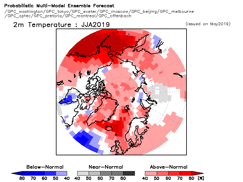
Surface air temperatures during the June, July, and August (JJA) 2019 period are forecast to be above normal across the majority of the Arctic regions (red areas in the figure below). The probability of such forecast is highest over the eastern Alaskan region (60-70%) and over the Atlantic region (>70%). Southern Scandinavia, the northern islands of the Canadian Archipelago, and the western portion of the continental Canadian Arctic, on the other hand, have a probability of at least 40% of an above-normal summer temperatures. The forecast is non-decisive over the other parts of Canadian Arctic and over northern Scandinavia (white areas in the figure below). Similarly, the probability of above-average summer air temperature ranges between 40% over the western part of the continental European Arctic, to 40-50% for eastern Siberia and the eastern portion of the Chukchi region, increasing to 60% for the westernmost part of the Chukchi region. The forecast is non-decisive over the eastern part of European Arctic and over the western edge of western Siberia (white areas in the figure below), while temperatures should remain near normal over the eastern portion of western Siberia (grey areas in the figure below).
Precipitation JJA 2019 Outlook
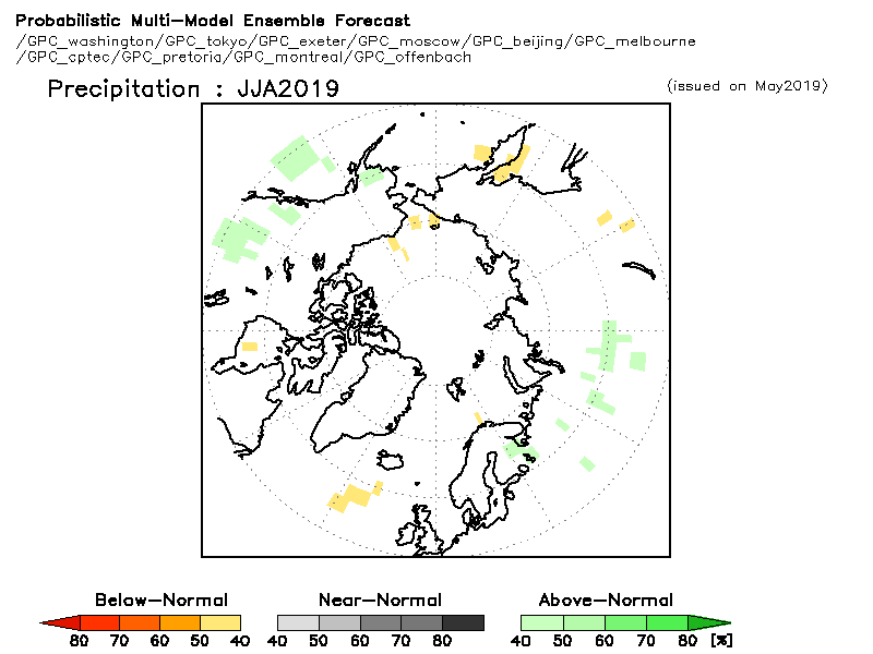
Precipitation forecast during JJA 2019 over the majority of the Arctic is non-decisive (white areas in the figure below). This result means that the seasonal forecasting models used to calculate probabilistic forecast could not agree on the expected amount of precipitation in summer. The few exceptions to this result are a probability of at least 40% for above normal precipitation for scattered areas over southern Alaska, the western European region and the Western Siberian region (green areas in the figure below).
Outlook for sea ice spring break-up and september sea ice extent 2019
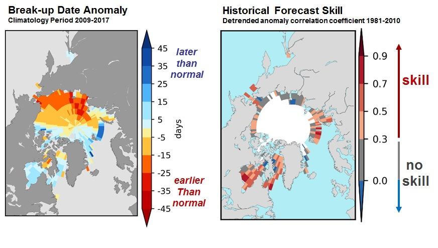
Forecast for the 2019 spring break-up where break-up is defined as the date when the ice concentration drops below 50%. The figure below shows the anomaly (difference from normal) based on the 2009-2017 period to the left, and the historical skill defined as the detrended anomaly correlation coefficient based on the 1981-2010 period the right. Late clearing is expected with moderate to high confidence for Hudson Bay, Baffin Bay and the Barents Sea, while early clearing is expected with moderate confidence in the Southern Beaufort Sea.
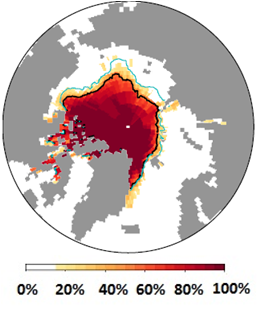
The figure below shows the September 2019 probability of sea ice at concentrations greater than 15% from CanSIPS (ECCC). Ensemble mean ice extent from CanSIPS (black) and observed mean ice extent 2009-2017 (green). The sea ice extent is expected to be below normal for the Barents Sea, below to near normal for the Chukchi Sea, East Siberian Sea, Laptev Sea, Kara Sea and Beaufort Sea,near normal for the Canadian Arctic Archipelago, and near to above normal for the Greenland Sea.