
This is the main result from the climate summary stated in the PARCOF-3 Consensus statement, for temperature, precipitation and sea ice during February, March and April 2019. View the full climate summary presentation for more details. During February, March and April (FMA) 2019, the temperatures were above normal, with the exception of the eastern Canadian Arctic where temperatures were below normal. The southern portion of the Canadian Arctic saw their driest FMA in the 70-year record, while northeastern Siberia and a portion of the Arctic Ocean saw their wettest FMA on record. The Northern Hemisphere March 2019 maximum sea ice extent was the 7th lowest on record. There were large regional differences observed in sea ice conditions between the Canadian and Eurasian Arctic during winter 2019. The thermal and wind patterns during winter 2018-2019 led to extreme low ice extent in the Bering Sea, while the predominance of northerly winds in the Barents Sea region since January 2019 led to close to normal ice extent in the northern part of this area.
Temperature FMA 2019 Summary
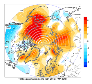
The figure shows the February, March, and April (FMA) 2019 temperature anomaly based on the 1981-2010 reference period from Hydrometcenter Moscow/NCEP/NCAR Reanalysis. The average surface air temperature in the Arctic domain north of 65°N was, in the majority, above normal (red areas). Particularly, Alaska, northwestern Canada, central Siberia, and the Beaufort, Chukchi and Bering Seas saw their warmest FMA since the start of the record in 1949. On the other hand, average surface air temperature over eastern Canadian Arctic for that same time period was only the 30th – 45th warmest, which is near the median for the same period. Click image to see forecast and climate summary side by side.
Click image to see forecast and climate summary side by side.
×
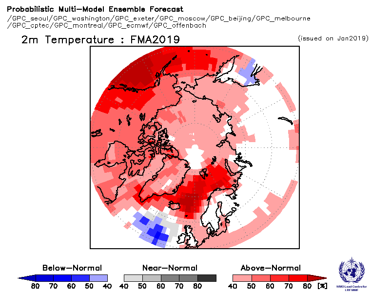
Forecasted temperature for February, March and April 2019.
Temperature summary for the same period.
Precipitation FMA 2019 Summary
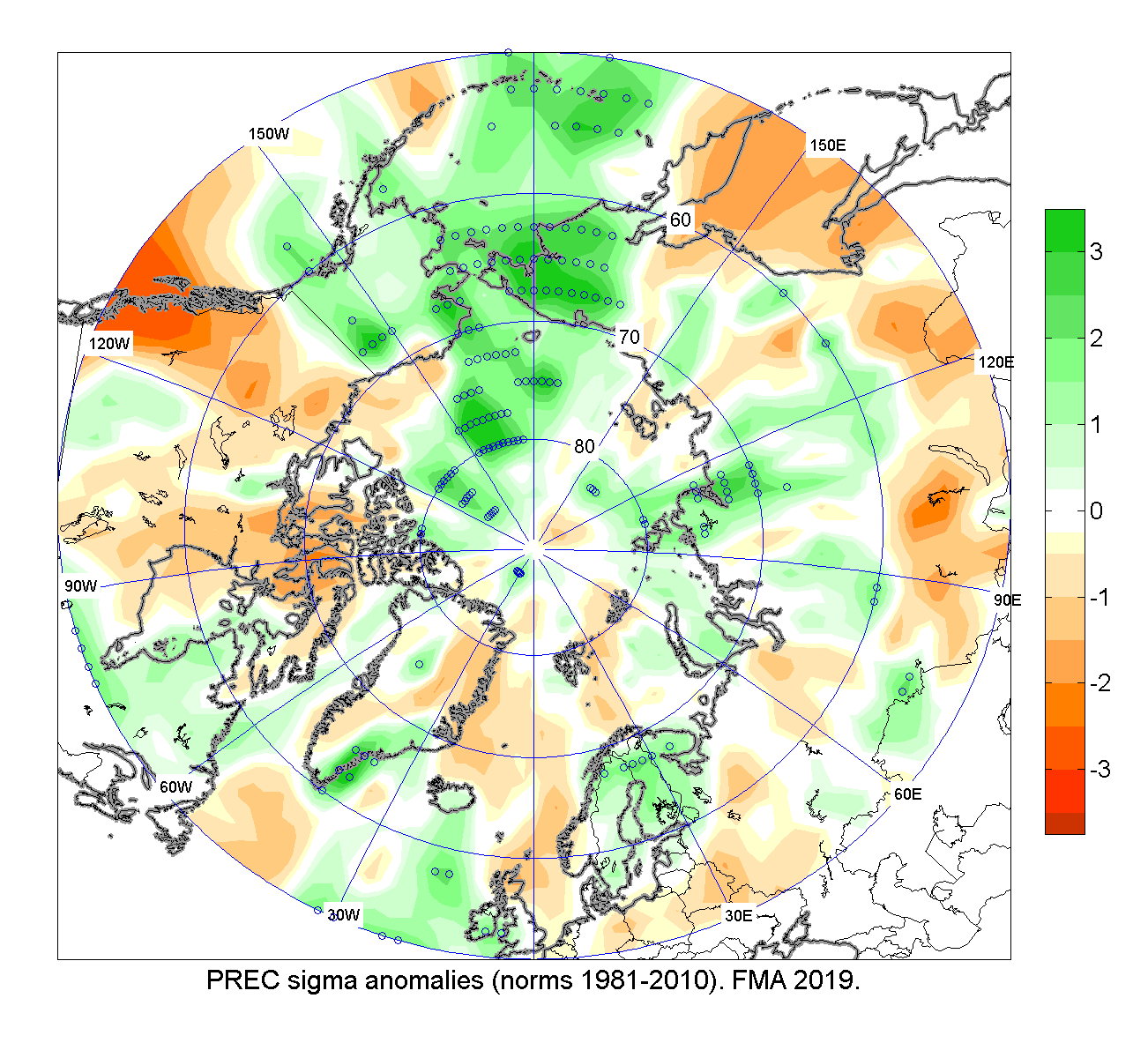
The figure shows the FMA precipitation anomaly based on the 1981-2010 reference period from NCEP/NCAR Reanalysis. The southern portion of the Canadian Arctic saw their driest FMA in the 70-year record, while northeastern Siberia and a portion of the Arctic Ocean saw their wettest FMA on record. Click image to see forecast and climate summary side by side.
Click image to see forecast and climate summary side by side.
×
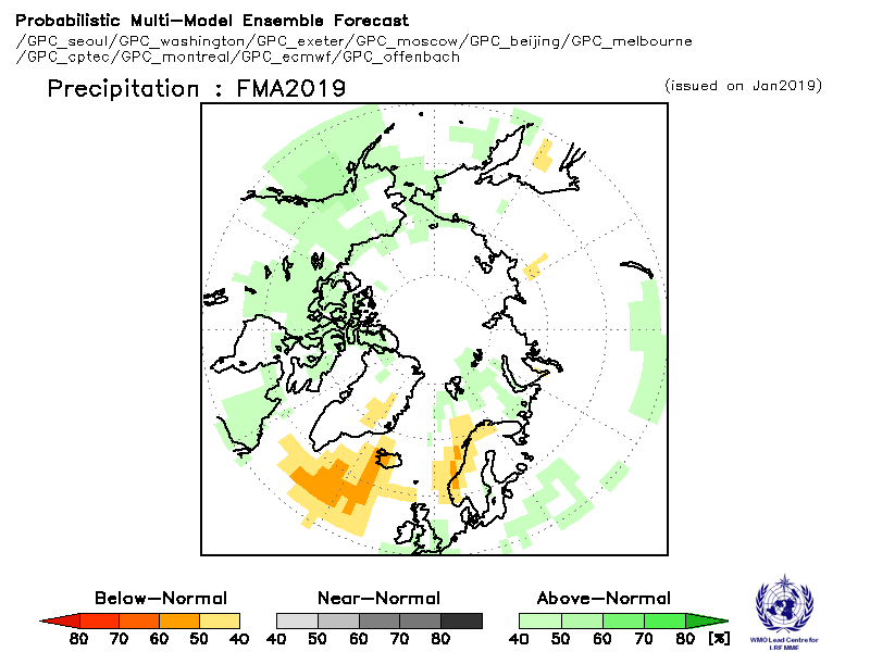
Forecasted precipitation for February, March and April 2019.
Precipitation summary for the same period.
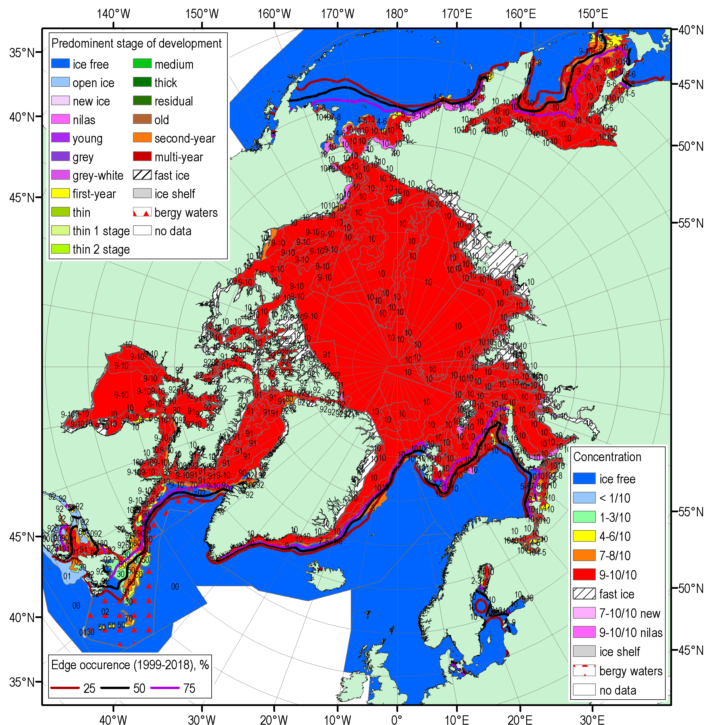
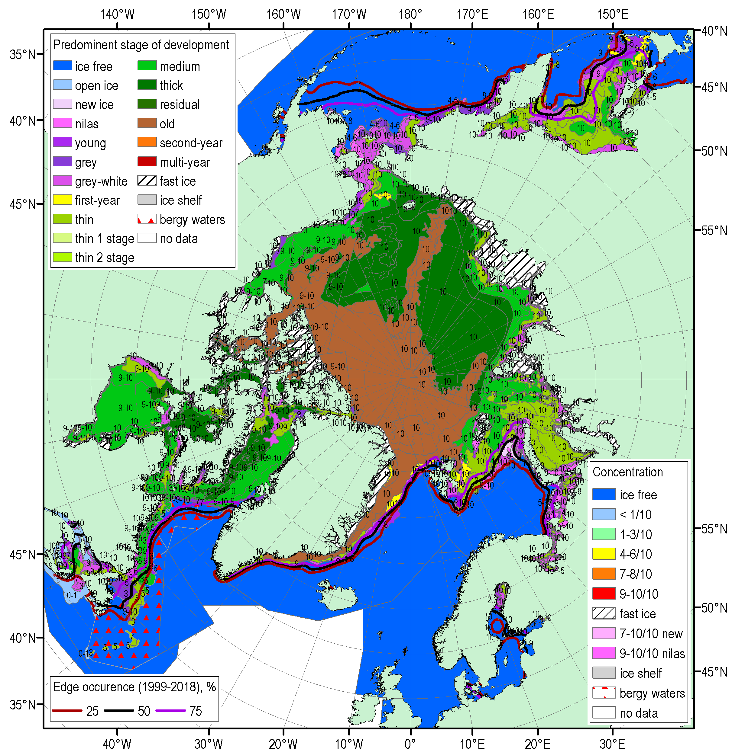
Sea Ice Summary for March 2019
The figures show the blended AARI/CIS/NIC ice chart for 19-22 March 2019, where the top figure is the total concentration, and the bottom figure is the predominant stage of development. The ice edge reference period is 1999-2018. The winter maximum sea ice extent (14.89 mln km2), reached on March 11, 2019, was the 7th minimum in row since 1979 (2018 – 2nd), with the maximum winter sea ice extent observed in 1979 (16.77 mln km2). Estimates of the sea ice volume, based on numerical reanalysis (HYCOM-CICE, PIOMAS), show slightly higher or similar to 2018 values, and significantly higher than in 2016-2017. Observed at coastal stations, maximum winter ice thicknesses was slightly less than normal for most of the Arctic seas with some positive anomalies observed in Kara sea and significant negative anomalies in Chukchi Sea region. At several stations (Baker Lake, Tiksi, Kotelny, North Pole) recorded vales (201 to 215 cm) were close to physical maximum for the first year ice. High variability of ice conditions was recorded during the observed period for some of the regional seas. The thermal and wind patterns during winter 2018-2019 led to extreme low ice extent in Bering Sea with close to normal ice extent in the adjacent Sea of Okhotsk. Predominance of northerly winds in the Barents Sea region since January 2019 led to close to normal ice extent in the northern part of this area; this is opposite both to 2018 as well as last decade situation.
No long-range forecast for sea ice for this period.